Washington Co. > 1911 USGS Map
The image below shows a 1911 USGS map covering parts of Washington and surrounding Counties. Use this image to determine which map section you want to view in a larger format, then scroll down. The towns indicated on the image are located directly below each name.
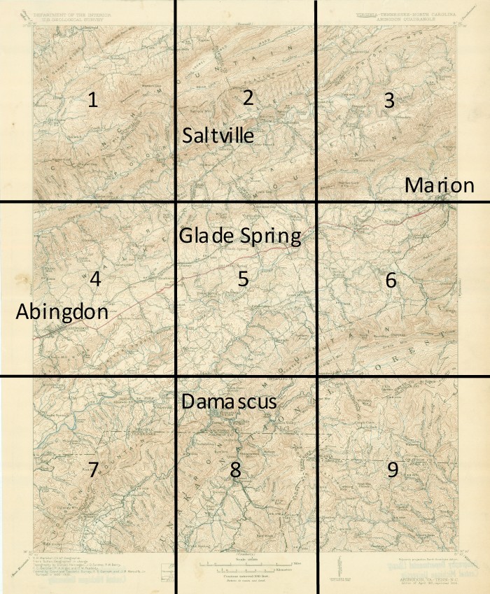
Map Sections
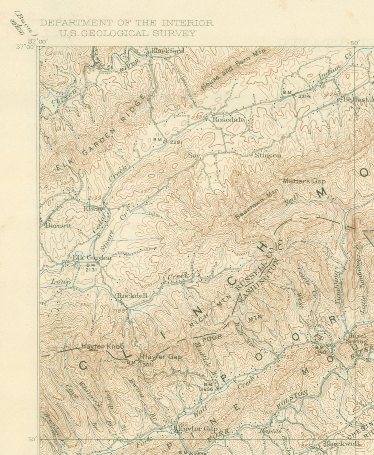
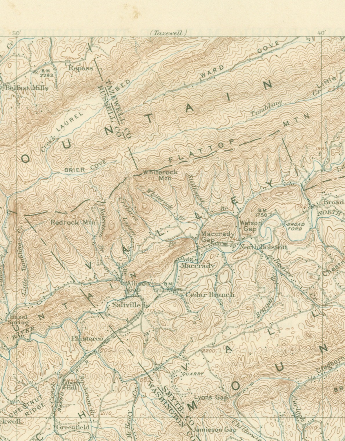
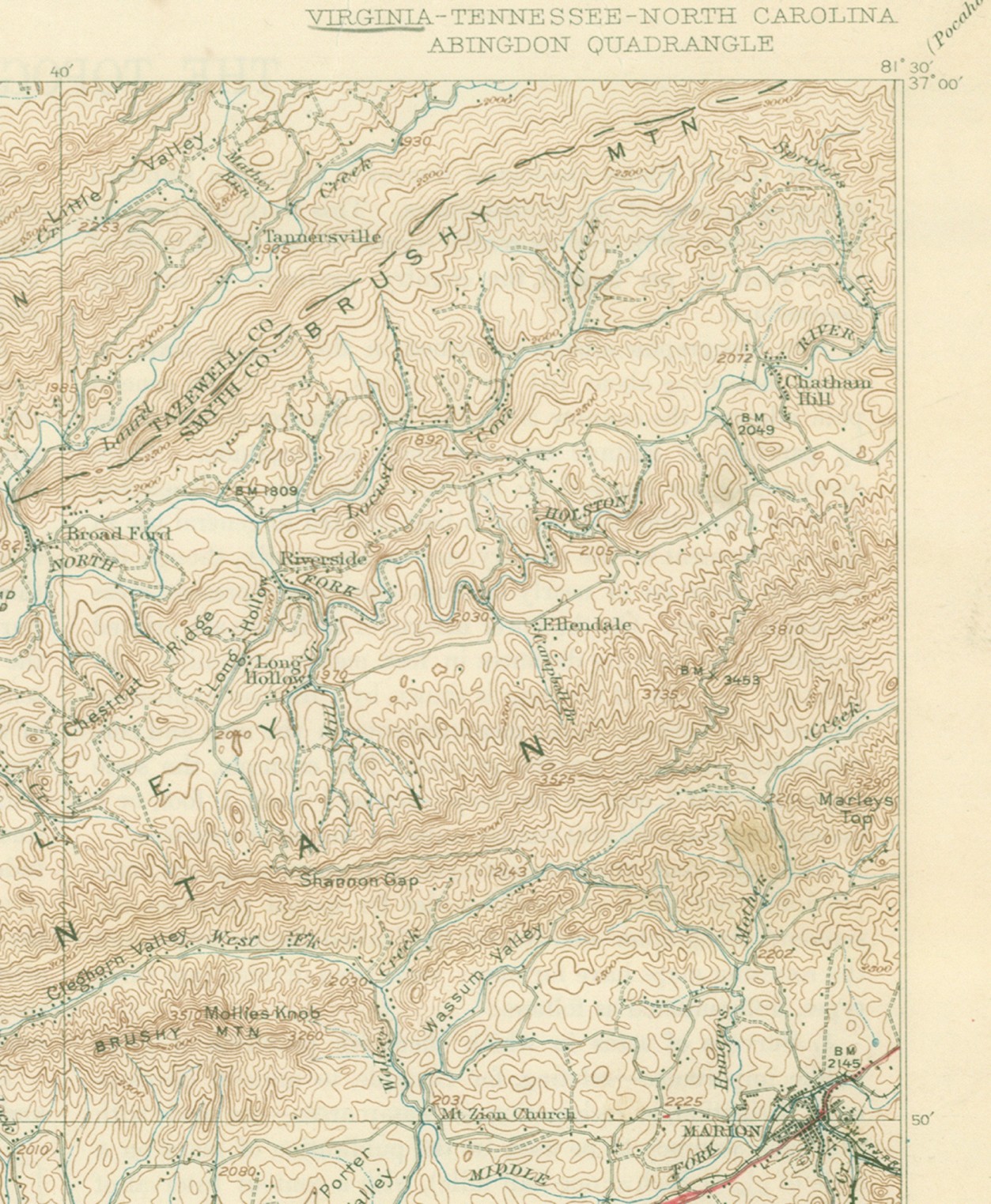
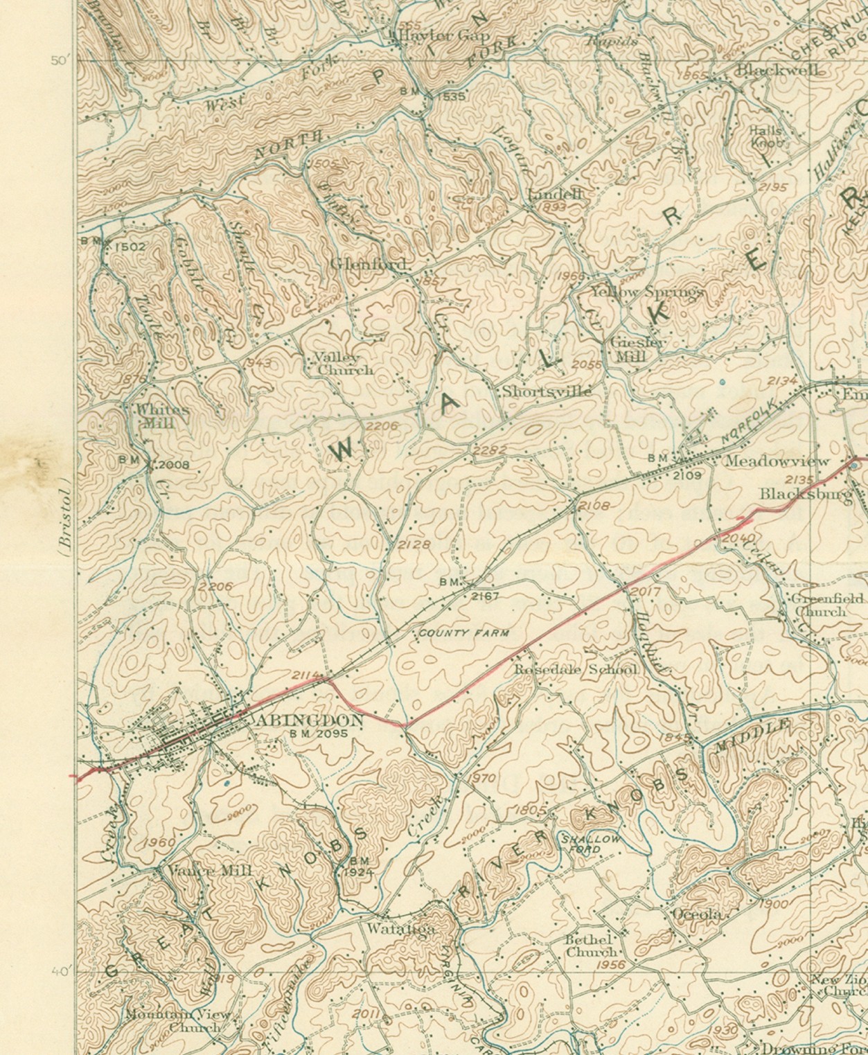
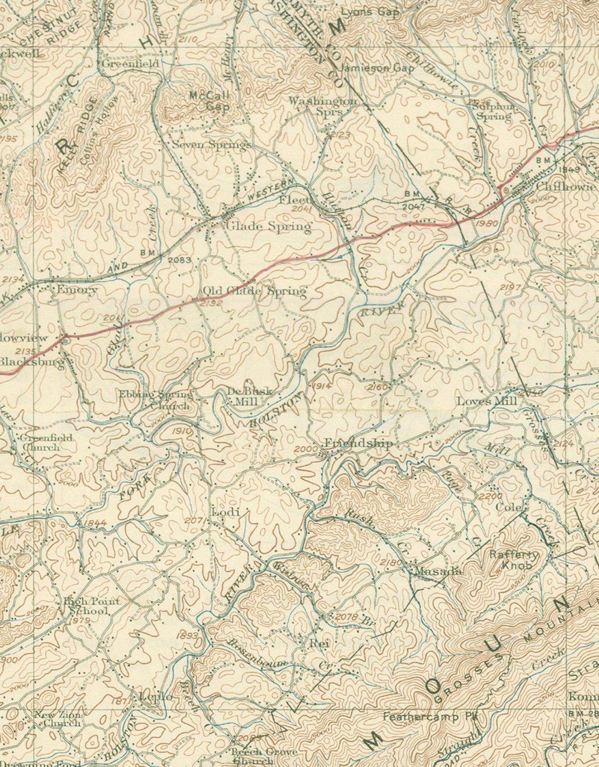
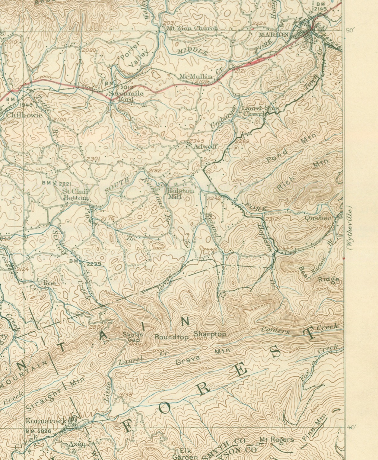
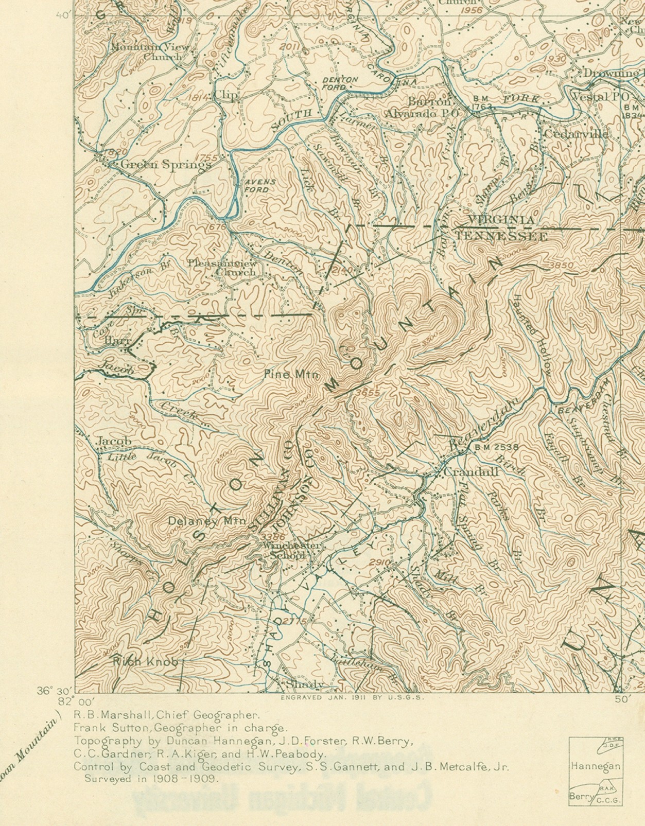
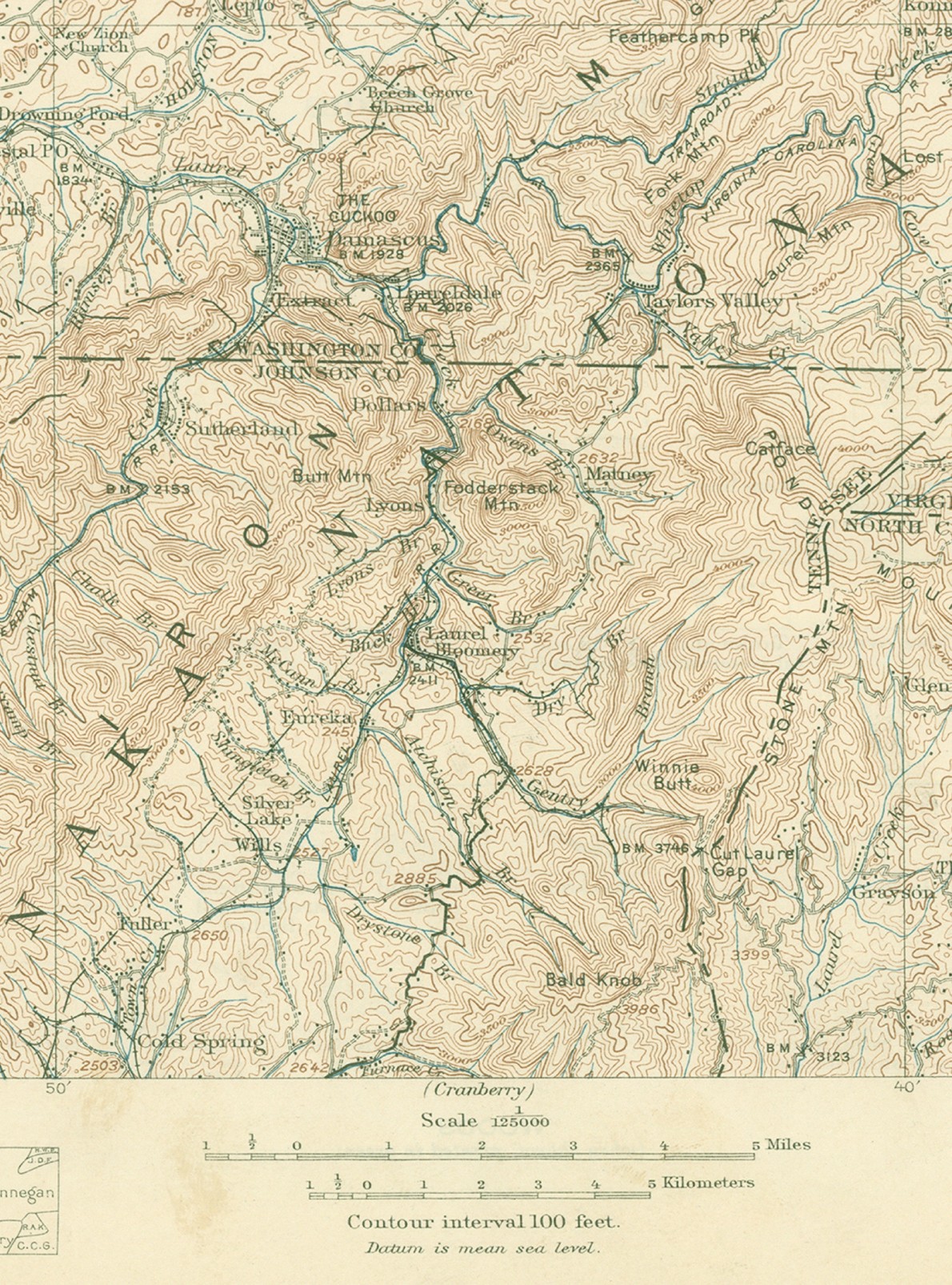
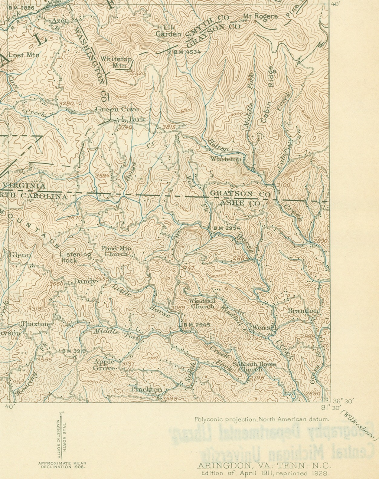
Click on any map section to open a larger image in your browser. Use the back arrow to return to this page. Each file is abt 600 KB in size.
Depending on your browser settings, the file may not open full size. The browser may say the zoom is at 100% but experiment with the zoom anyway as many browsers adjust the zoom so the image just fills the vertical dimension of the screen. You should have to scroll up and down to see the full map segment on most monitors.
Unfortunately, the previous owner marked Rt. 11 in red. They didn't do a very careful job of it, but the red line does serve as a visual landmark, especially since Rt 11 more or less followed the Old Wagon Road.