Misc. Locations > Jeremiah Gardner Texas Land
The Republic of Texas, as a means of encouraging settlement, began issuing certificates in 1836 entitling the holder to a specific amount of land. Various types of certificates were issued in the ensuing years, depending on the year of arrival, military service, etc. The person awarded the certificate was called the grantee. The certificate was not associated with a particular tract of land; instead the holder of the certificate was responsible for locating land, having it surveyed and completing the patent process. Sometimes the grantee also became the patentee. But the certificate (or part of it) could also be sold in which case the purchaser became the patentee. However for record keeping purposes the name of the original grantee remained associated with the parcel. Hence Texas General Land Office maps label parcels by the original grantee, not by the person who actually patented and hence owned the land.
When Jeremiah Gardner arrived in Texas he purchased certificates (or unused portions of certificates) from two men, the first being a Robert McGahee. McGahee's certificate changed hands several times before it came into the possession of James McCamant who used part of it to patent 400 acres in Hunt Co. in Oct. 1857. James sold the right to the remaining 240 acres to Jeremiah Gardner who patented land in Hunt Co. in Dec. 1857.
On April 3, 1860 Jeremiah purchased a certificate for 640 acres from Harman Husband for $500. It had originally been granted to Francis Leonard. Jeremiah patented several tracts of land from the certificate: 118 acres in Hunt Co. (patented 2 Feb. 1871) and 96.4 acres in Fannin Co. (patented 7 Aug. 1861). The 118 acres was surveyed in July 1861 and filed that Dec. but for some reason the patent was not issued until many years later.
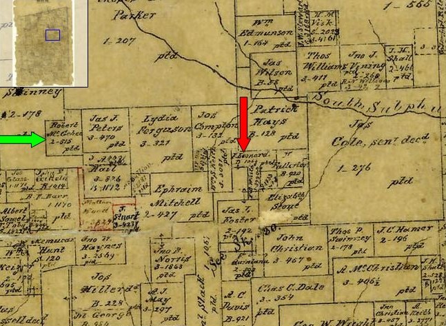
The image below is from an 1859 map of Hunt Co. The green arrow points to the land Jeremiah purchased with the McGahee certificate and the red arrow points to the land Jeremiah acquired with a portion of the Leonard certificate.
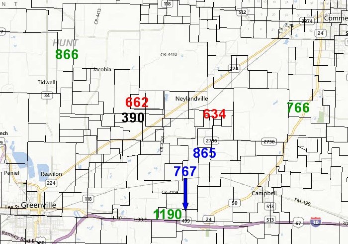
The map below shows the location of Jeremiah's two Hunt Co. parcels as well as several of the tracts belonging to his 3 McCamant sons-in-law. The numbers are abstract numbers used to identify that particular transaction and are useful for searching in the Texas General Land Office Database (make URL). In 1860 Alexander McCamant (abstract 390) was enumerated in a household shared with Jeremiah Gardner (abstracts 662 & 634) suggesting the two families probably lived on the parcels indicated at 662 and 390.
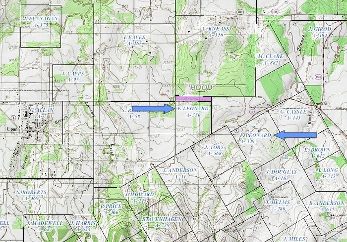
Jeremiah used the balance of the Francis Leonard certificate to acquire land in Hood County after the family settled there in the late 1860s. Although Jeremiah would have settled on the land much earlier, the patents were not finalized in Jeremiah's name until Jan. 3, 1874 by which time Jeremiah was deceased.
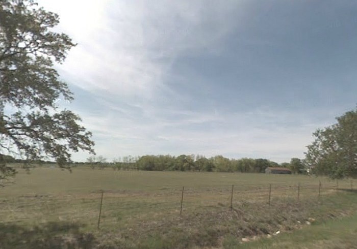
The map below shows the location of Jeremiah's Hood Co. patents. The second image shows the view from Lipan Rd. across the old Gardner property on the south side of the road.