Misc. Locations > Missouri, Andrew County
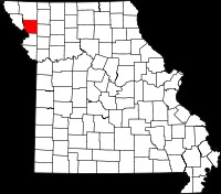
Andrew Co. lies in the northwest corner of the state of Missouri. The Missouri River forms part of its western boundary, dividing it from the state of Kansas. Andrew Co. was created in 1841 from Indian land acquired by the federal government in 1837 as part of the Platte Purchase.
Several Washington Co., Virginia families settled in Andrew County in the early 1840s, including David Beattie, son of David Beattie Sr. and Mary Beattie. David S. Beatie, son of James G. Beatie and Elizabeth Stephenson was also an early settler. The two Davids were first cousins, once removed. They settled near each other on land in what was originally Platte Township (Empire Twp after 1872). John Wilson Porterfield, also a relative, joined them around 1851. He settled in Jackson township
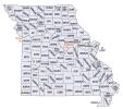
The two thumbnails below (click for larger image) provide links to additional maps. The first identifies neighboring counties; the second shows Andrew County townships as of 1930.
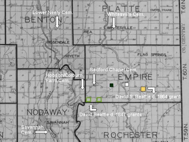
The map below is a cropped section from the 1930 Andrew Co. plat book. I have indicated the location of several Beattie land grants as well as the location of 5 cemeteries.
The following grants were all in Township 60N, Range 34W:
- green: David Beattie purchased part of the SW 1/4 of section 31 on 29 Jun 1846; also the SW 1/4 of section 32 on 19 Jul 1846
- yellow: David S. Beatie purchased the SW 1/4 of section 25 on 26 Dec. 1850
- black: Armstrong Beattie purchased the SE 1/4 of the NW 1/4 of section 28 on 23 Jul 1851
- white: David Beatie (which one?) purchased the NE fractional quarter of section 27 on 5 June 1847
David and Nancy Beatie are believed to be buried at Colburn Farm cemetery although no headstone has been located. Other family members are buried at Bedford Cemetery or Whitesville Cemetery. John Porterfield and many of his family are buried at Lower Neely cemetery. Descendants of many early settlers are buried at Savannah Cemetery
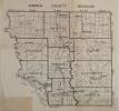
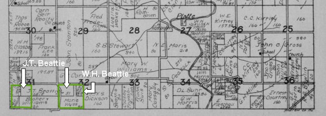
The map below is an even closer look at the 1930 plat book for the southern part of Township 60N, Range 34W. Note that portions of David Beattie's land were still held by his grandsons William H. and Joseph T. Beattie in 1930.
A few websites I found interesting include:
- The Andrew Co. USGenWeb page has a wonderful collection of links. For instance see the link on the right side to the 1930 Andrew Co. Plat Book
- The Photograph Andrew Co. Tombstones (PACT) Project website has cemetery location maps and many, many headstone photos.
- The Missouri Office of the Secretary of State website has a lot of very useful content, including digitized death certificates and information on Missouri Land Patent Records. A good starting place is the Family and Faith page (be sure to scroll all the way down to the links for Land Records.
- The Wikipedia page for the Platte Purchase has interesting information and maps.
- This site presents historical information on the creation of Andrew Co. townships.
- The official website for Andrew County