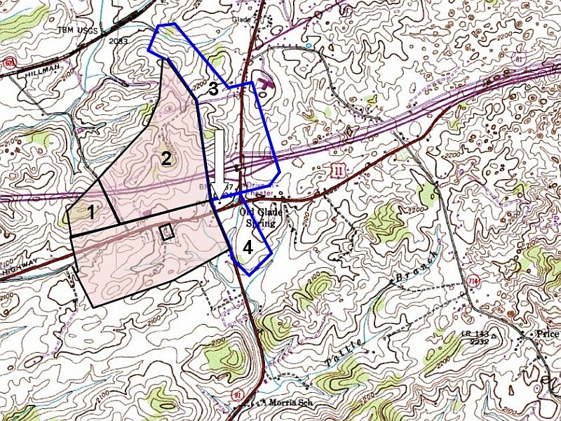
Fig 7. Beattie to Robinson and Snead; Robinson to Snead
Platting 18th or 19th century surveys and placing them on 20th century maps is an inexact science. Landmarks change, roads are rerouted, even the path of a stream may shift. The tools available to the surveyor have improved as well.
It is difficult to know, from plat work alone, if Nickerson Snead's brick house, which still stands today, was built on parcel #3 (Wm Beattie to Snead) or parcel #4 (Robinson to Snead) as shown. The NW corner of the 1837 Robinson to Snead survey was 10 poles [165 feet or 33 yards] from the northern edge of the Great Rd. But it is unlikely the northern edge of Rt. 11 sits in the exact same place the northern edge of the Great Rd. did 150 years ago. If the house was built after Sept. 1837, by which time Snead owned both parcels 3 and 4, it is even possible the house straddled both sides of the earlier division line.