Fig. 2. Jan 19, 1774 survey for Francis Kincannon of 546 acres in (then) Fincastle Co., VA - plat map
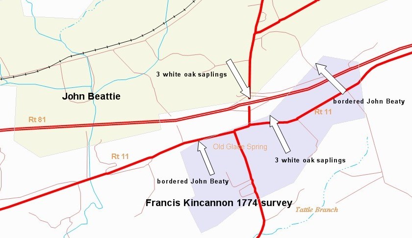
John Beattie’s land was originally patented to James Wood in Sept. 1755 and surveyed at that time. Many sides of the tract were measured using a longer than normal pole which produced fewer total poles and hence less overall acreage (translating to less taxes). A plat drawn today from those improperly measured metes and bounds is smaller on paper than it was on the ground. John Beattie’s land actually extended further south and bordered Francis Kincannon’s 1774 survey. The actual shape and position of both men’s land is more accurately reconstructed using later surveys.
Present day Rt. 11 generally follows the Old Stage Road, although in some places it has been straightened or the path altered as the road was widened. Rt 11 was rerouted south of I-81 east of Old Glade Spring when the freeway infringed on the original road